|
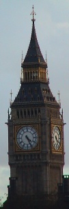
Location of St. Pancras Church
Other links to St. Pancras Church
Restaurants in the area
North Sea (distance = 356 m bearing 146°)
Local Pubs
Lord John Russell (distance = 308 m bearing 142°)
, Norfolk Arms (distance = 290 m bearing 57°)
Nearby sights
Euston Road 215 - Welcome Trust (distance = 310 m bearing 230°)
, Fitzroy Square 6 (distance = 343 m bearing 230°)
, Builders & Contractors - Kenton Street (distance = 406 m bearing 143°)
, Mary Ward House (distance = 282 m bearing 132°)
, St Pancras Station (distance = 489 m bearing 39°)
, Christ the King (distance = 407 m bearing 212°)
, British Medical Association (distance = 165 m bearing 130°)
, The British Library (distance = 312 m bearing 38°)
, Former Middland Hotel (distance = 400 m bearing 43°)
, University College Hospital (distance = 480 m bearing 228°)
, University College (distance = 406 m bearing 222°)
, Gandhi, Mohandas Karamchand (distance = 246 m bearing 123°)
, Trevithick, Richard (1771 - 1853) (distance = 471 m bearing 216°)
, Burton Street (distance = 153 m bearing 141°)
, Cartwright Gardens (distance = 215 m bearing 146°)
, Duke's Road (distance = 54 m bearing 147°)
, Gordon Square (distance = 326 m bearing 212°)
, Marchmont Street (distance = 390 m bearing 140°)
, Tavistock Place (distance = 323 m bearing 138°)
, Tavistock Square (distance = 237 m bearing 123°)
, Woburn Walk (distance = 68 m bearing 132°)
Nearby Neighbours (Plaques)
Abbas, Ali Mohammed ( 1922 - 1979 ) (distance = 170 m bearing 125°)
, HERFORD, Robert Travers (1860-1950), (distance = 312 m bearing 215°)
, HUGHES, Hugh Price (1847-1902), (distance = 145 m bearing 217°)
, KEYNES, John Maynard (1883-1946), (distance = 312 m bearing 215°)
, NASH, Paul (1889-1946), (distance = 203 m bearing 51°)
, STRACHEY, Lytton (1880-1932), (distance = 312 m bearing 215°)
Notorious sights in the area
Strachey, Lady Jane - Suffragist (distance = 327 m bearing 212°)
General Links Local Map
Map of what is in the area - using Google map
|