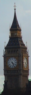
Location of Mitre Square
Other links to Mitre Square
Restaurants in the area
Chamberlains (distance = 377 m bearing 232°)
, Lanes Restaurant and Bar (distance = 300 m bearing 35°)
Local Pubs
Aldgate Wine Bar (distance = 232 m bearing 215°)
, All Bar One (distance = 465 m bearing 211°)
, CJs (distance = 499 m bearing 228°)
, East India Arms (distance = 207 m bearing 212°)
, Elephant and something (distance = 425 m bearing 226°)
, English Club (distance = 324 m bearing 123°)
, Hoop and Graps (distance = 183 m bearing 213°)
, Hung, Drawn and Quartered (distance = 476 m bearing 218°)
, Jamaica Wine House (distance = 486 m bearing 236°)
, The City Darts (distance = 486 m bearing 47°)
, The Market Trader (distance = 364 m bearing 39°)
, The Pump House (distance = 390 m bearing 223°)
, The Ship (distance = 407 m bearing 224°)
, The Weatherspoon (distance = 485 m bearing 122°)
, Three Tons (distance = 178 m bearing 133°)
, Wine Lodge (distance = 443 m bearing 226°)
Shops in the area
Leadenhall (distance = 367 m bearing 233°)
Nearby sights
122 Leadenhall Street (distance = 381 m bearing 235°)
, 20 Fenchurch Street (distance = 461 m bearing 226°)
, Bishopsgate Church Yard (distance = 439 m bearing 314°)
, Swiss Re Tower (Gherkin) (distance = 162 m bearing 323°)
, Tower 42 (distance = 396 m bearing 324°)
, Trinity House (distance = 409 m bearing 122°)
, Trinity Square 10 (distance = 411 m bearing 121°)
, Old Turkish Baths (distance = 414 m bearing 314°)
, Spanish and Portuguese Synagogue (distance = 70 m bearing 321°)
, St Andrew Undershaft (distance = 162 m bearing 236°)
, St Botolph Bishopsgate (distance = 383 m bearing 311°)
, St Botolph without Aldgate (distance = 157 m bearing 57°)
, St Ethelburga the Virgin (distance = 294 m bearing 319°)
, St Helen's (distance = 237 m bearing 324°)
, St Katherine Cree (distance = 59 m bearing 213°)
, St Margaret Pattens (distance = 462 m bearing 222°)
, St Michael Cornhill (distance = 487 m bearing 236°)
, St Olave (distance = 384 m bearing 212°)
, St Peter upon Cornhill (distance = 454 m bearing 236°)
, Lloyds (distance = 306 m bearing 233°)
, Lloyds Register (distance = 203 m bearing 211°)
, Osborne House - Nation Association of Flowe Arrangers (distance = 318 m bearing 302°)
, London Underwriter Centre - Minster Court (distance = 449 m bearing 215°)
, Leadenhall Market (distance = 379 m bearing 234°)
, Merchant Navy and fishing fleets Memorial (distance = 484 m bearing 121°)
, Pepys, Samual (distance = 429 m bearing 211°)
, Tower Hill Scaffold (distance = 476 m bearing 121°)
, Austin Friars Square (distance = 499 m bearing 323°)
, Devonshire Square (distance = 300 m bearing 303°)
, St Helen's Place (distance = 283 m bearing 322°)
, St Michaels Alley (distance = 497 m bearing 235°)
, Widegate Street - Spitalfields (distance = 439 m bearing 32°)
Nearby Neighbours (Plaques)
CLAYTON, Reverend P.T.B. Tubby (1885-1972), (distance = 419 m bearing 121°)
, MALLON, Dr Jimmy, CH (1874-1961), (distance = 187 m bearing 33°)
, ROSENBERG, Isaac (1890-1918), (distance = 339 m bearing 56°)
, STRYPE STREET. (distance = 342 m bearing 36°)
Notorious sights in the area
Baltic Exchange - Bomb (distance = 159 m bearing 324°)
, Bishopsgate - Bomb (distance = 330 m bearing 313°)
, Execution Site - Tower Hill (distance = 484 m bearing 122°)
, Jack the Ripper - Catherine Eddowes (distance = 40 m bearing 137°)
, Mr Lloyds coffee house (distance = 484 m bearing 213°)
, Tower Hill - Disaster (distance = 484 m bearing 122°)
, Tower Street Explosion (distance = 484 m bearing 213°)
, Walsingham, Sir Francis (1532-1590) - Spys (distance = 405 m bearing 211°)
General Links
Local Map
Map of what is in the area - using Google map